
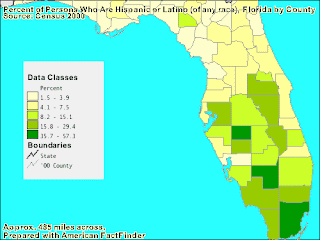
A classed choropleth is a map that uses different shades and intensities of colors to group data into different classes. The main classes used are equal frequency, equal interval, and natural breaks. This map shows the different Florida counties and the percentage of their population that is Hispanic.
No comments:
Post a Comment